Welcome

Добро пожаловать к этому международному месту открытки изображения. Benvenuto a questo luogo internazionale della cartolina di immagine. Καλωσορίστε σε αυτήν την διεθνή περιοχή καρτών εικόνων. Willkommen zu diesem internationalen Abbildungspostkarteaufstellungsort. Bienvenue à cet emplacement international de carte postale. Onthaal aan deze Internationale plaats van de beeldprentbriefkaar. Welcome to this International picture postcard site. (Please Click on the Picture for an Enlarged View)

Thursday, December 26, 2013

Centenary of the Opening of traffic on the Valga-Moniste-Gulbene-Pjavinas narrow gauge railway in 1900.

The history of rail transport in Estonia starts in 1870 when a line was opened connecting Paldiski, Tallinn, Tapa and Narva; the line extending all the way to St. Petersburg in Russia.

Ella sent me this card which was issued to commemorate the Centenary of the Opening of traffic on the Valga-Moniste-Gulbene-Pjavinas narrow gauge railway in 1900.

Wednesday, December 25, 2013

The Estonian Maritime Museum's Seaplane Harbour

The Estonian Maritime Museum's Seaplane Harbour was named as a nominee for the European Museum of the Year Award (EMYA) 2014. 

The Seaplane Harbour of the Estonian Maritime Museum was opened in May 2012 and has had more than 550,000 visitors since. In 2014, the steam-powered icebreaker Suur Tõll will celebrate her 100th birthday. For that occasion, she will be renovated and a new exhibition describing her history will be prepared. The icebreaker will be reopened to the public on 19 June 2014.
With the help of modern multimedia, the Seaplane Harbour in the wooden architecture suburb Kalamaja tells exciting stories about the Estonian maritime and military history promising a “sea full of excitement” for the whole family on an area that would take nearly 2 million A4 paper sheets laid down side by side. The museum’s display, that comprises of more than a couple of hundred large exhibits, revitalizes the colourful history of Estonia.

British built submarine Lembit weighing 600 tones is the centrepiece of the new museum. Built in 1936 for the Estonian navy, Lembit served in the World War II under the Soviet flag. It remained in service for 75 years being the oldest submarine in the World still in use until it was hauled ashore in 2011. Despite its long history, Lembit is still in an excellent condition offering a glimpse of the 1930s art of technology.

Another exciting attraction is a full-scale replica of Short Type 184, a British pre-World War II seaplane, which was also used by the Estonian armed forces. Short Type 184 has earned its place in military history by being the first aircraft ever to attack an enemy’s ship with an air-launched torpedo. Since none of the original seaplanes have survived, the replica in Seaplane Harbour is the only full-size representation of the aircraft in the whole World.

Simulators mimicking a flight above Tallinn, around-the-world journey in the yellow submarine, navigating on the Tallinn bay make this museum heaven for kids or adventurous adults.  

Seaplane Harbour operates in architecturally unique hangars built almost a century ago, in 1916 and 1917, as a part of Peter the Great sea fortress. These hangars are the World’s first reinforced concrete shell structures of such a great size. Charles Lindbergh, the man who performed the first solo flight across the Atlantic Ocean, landed here in 1930s. In 2012 the hangars were rewarded with best concrete building of the year title.  

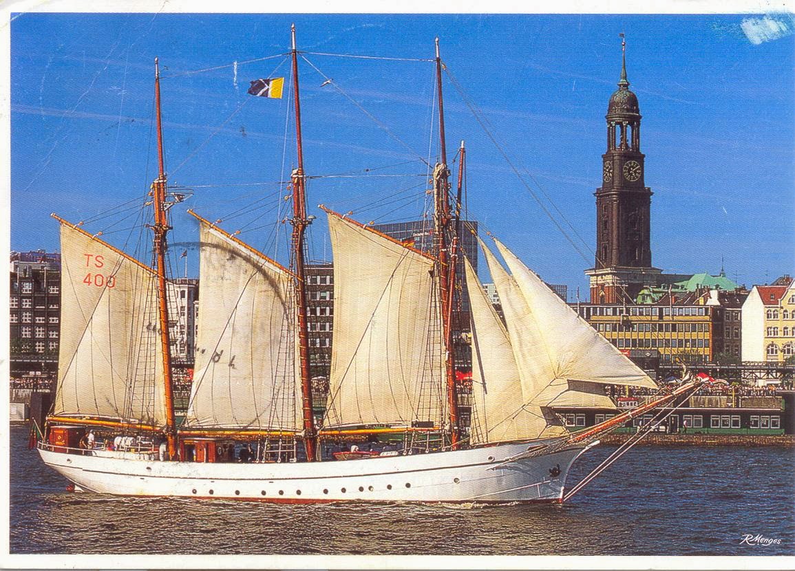
On the outdoor area visitors can tour a collection of historic ships, including the Suur Tõll, Europe's largest steam-powered icebreaker.

Thank you Ella.

Tuesday, December 24, 2013

Wish you All a Very Merry Christmas and a Great New Year


These cards were sent to me by my Wonderful friends in Finland and in Germany. Thank you My Dears. I wish you all and all visitors to my blogs a Very Merry Christmas and a Great New Year.

110th Anniversary of Estonia's first narrow gauge Barnu to Balga route

This maxicard was issued with the special stamp and postmark to celebrate the 110th Anniversary of Estonia's first narrow gauge (750 mm) Barnu to Balga 125 km route which was opened to traffic on October 05, 1896. The stamp and card were released at Tallinn on 17.10.2006.
The Barnu station building is shown on this card.
Thank you Ella for this nice card.

Monday, December 23, 2013

135th Anniversary of Haapsalu Railway Station

135th Anniversary of Haapsalu Railway Station. 

Haapsalu is a major seaside resort town set on the West Coast of Estonia located approximately 100km south-west from Tallinn, Estonia.  Haapsalu established in 1279, is well-known for its historic and maritime ambience, warm sea water, curative mud baths and friendly residents. It's a wonderful little town with narrow streets for families and romantic couples who enjoy having picnics, walking, visiting spas and taking mud baths, sailing and swimming.

The Keila-Haapsalu railway line was constructed between 1903 and 1905 to serve the resort town of Haapsalu - a favourite among the Russian aristocracy.

Erected to the designs of architect Karl Werheim, the grand historicist-style station building not only had an area for passengers but also a summer cafe and an imperial pavilion. The unusually long covered platform makes the station complex unique. The old railway embankment has been rebuilt as part of the County health trail, which offers a range of options for sports and hiking along a route from Riisipere via Haapsalu to RohukülaThe railway station's waiting area also serves as a bus station.

Thank you Ella.

Sunday, December 22, 2013

Estonian Museum Railway in Lavassaare

Estonian Museum Railway in Lavassaare – is the biggest narrow-gauge railway museum in the Baltic States and one of the biggest in Europe, where there are more than 65 items of rolling stock exhibited. The first narrow-gauge railway in Estonia was opened on the 5th October 1896 between the towns of Pärnu and Valga. In summertime runs the museum train and it is possible to organize a picnic in a picnic train.

Lavassaare Railway Museum. The third-largest museum of its kind in whole of Europe, Estonia's narrow gauge railway museum displays a whole host of locomotives from Estonia, Latvia and Lithuania as well as equipment and other train-related artefacts. Best of all, on Saturdays visitors can ride the museum's own train, which runs from Lavassaare (see website for schedule). The museum is only open between June and September, but anyone dropping by the rest of the year will still get a look at the dozen or so engines in the yard.


Thank you Ella for this pretty card.

Saturday, December 21, 2013

Helsinki Stamp Fair

This maxicard was issued by Aland to commemorate the Helsinki Stamp Fair 2013. On the card is depicted a 2012 model Nissan Note postal car.

Thank you Ella.

Friday, December 20, 2013

Kyrenia II

This maxicard was released in Paphos, Cyprus on 22.2.1991 to commemorate the “Kyrenia Ship” which was built during the 4th Century BC, and sank around 300 BC near the harbour of Kyrenia. This ship was salvaged, restored, reassembled and is today the world's oldest preserved vessel.

Kyrenia II which is a full size replica of the original ancient ship was built in 1987 and travels the world. The scope of her travel: a message for freedom, for the old vessel and her hometown Kyrenia which are both illegally in Turkish hands since the bloody invasion of the island by Turkish troops in July 1974.

Thank you Merja for this lovely card.

Tuesday, December 10, 2013

Kenting National Park

Kenting National Park is a national park located in the Hengchun Peninsula of Pingtung County, Taiwan, covering Hengchun, Checheng and Manzhou Townships. Established on January 1, 1984, it is Taiwan's oldest and southernmost national park, covering the southernmost area of the Taiwan Island. Administered by the Executive Yuan's Ministry of the Interior, this national park is well known for its tropical climate and sunshine, scenic mountain and beach, the Spring Scream rock-band festival held in every March, and has long been one of the most favorite resort places in Taiwan.
Thank you Yan-Ru for this lovely card.

Friday, December 06, 2013

The Goldcrest

The Goldcrest (Regulus regulus) is a very small passerine bird in the kinglet family. Its colourful golden crest feathers gives rise to its English and scientific names, and possibly to it being called the "king of the birds" in European folklore. Several subspecies are recognised across the very large distribution range that includes much of Eurasia and the islands of Macaronesia. Birds from the north and east of its breeding range migrate to winter further south.
This kinglet has greenish upper-parts, whitish under-parts, and has two white wingbars. It has a plain face contrasting black irises and a bright head crest, orange and yellow in the male and yellow in the female, which is displayed during breeding. It superficially resembles the Firecrest, which largely shares its European range, but the latter's bronze shoulders and strong face pattern are distinctive. The song is a repetition of high thin notes, slightly higher-pitched than those of its relative. Birds on the Canary Islands are now separated into two subspecies of the Goldcrest, but were formerly considered to be a subspecies of the Common Firecrest or a separate species, Regulus teneriffae.
The Goldcrest breeds in coniferous woodland and gardens, building its compact, three-layered nest on a tree branch. Ten to twelve eggs are incubated by the female alone, and the chicks are fed by both parents; second broods are common. This kinglet is constantly on the move as it searches for insects to eat, and in winter it is often found with flocks of tits. It may be killed by birds of prey or carry parasites, but its large range and population mean that it is not considered to present any significant conservation concerns.

Halina sent me this lovely card.

Thursday, December 05, 2013

Sault Ste. Marie

Now here’s an interesting place in the US of A. Sault Ste. Marie is a city in and the county seat of Chippewa County in the U.S. state of Michigan. It lies on the northeastern end of Michigan'sUpper Peninsula, on the Canadian border, separated from its twin city of Sault Ste. Marie, Ontario, by the St. Marys River. The city is relatively isolated from other communities in Michigan. The population was 14,144 at the 2010 census, making it the second most populous city in the Upper Peninsula.
Sault Ste. Marie was already a place of Native American settlement 500 years ago. It became the first European settlement in the region that became the Midwestern United States, when, in 1668, Father Jacques Marquette, having heard of the Native American village, traveled there to found a Catholic mission. A fur-trading settlement quickly grew at the crossroads that straddled the banks of the river, the center of a trading route of 3,000 miles (4,800 km) that extended from Montreal to the Sault, and from the Sault to the country north of Lake Superior.
The settlement formed a single community until 1817, when a US–UK Joint Boundary Commission fixed the border between the Michigan Territory of the USA and the British Province of Upper Canada to follow the river in this area. The American and Canadian communities were each incorporated as municipalities toward the end of the nineteenth century.
Sault Sainte-Marie translates from French as "the Rapids of Saint Mary". The Saint Mary's River runs from Lake Superior to Lake Huron, separating the twin border cities.
No hyphens are used in the English spelling, which is otherwise identical to the French, but the pronunciations differ; Anglophones say suː seɪnt məˈriː/ and Francophones say [so sɛ̃t maʁi]. In both languages, the name is often written Sault Ste. Marie. On both sides of the border, the towns and the general vicinity are called The Sault or The Soo.
The two cities are joined by the International Bridge which connects Interstate Highway 75 in Sault Ste. Marie, Michigan, and Huron Street in Sault Ste. Marie, Ontario. Shipping traffic in the Great Lakes system bypasses the rapids via the American Soo Locks, the world's busiest canal in terms of tonnage passing through it, while smaller recreational and tour boats use the Canadian Sault Ste. Marie Canal. The city's downtown sits on an island, with the locks to the north, and the Sault Ste. Marie Power Canal to the south.
People come from around the world to view shipping traffic pass through the locks. The largest ships are 1,000 feet (300 m) long by 105 feet (32 m) wide. These are domestic carriers (called lakers) too large to transit the Welland Canal that bypasses Niagara Falls and, consequently, are land-locked. Foreign ships (termed salties) are smaller.
Sault Ste. Marie is also the home of the International 500 Snowmobile Race (commonly called the I-500), which takes place annually and draws participants and spectators from all over the U.S. and Canada. The race, which was inspired by the Indianapolis 500, originated in 1969 and has been growing ever since.
Thank you Bethaney for this nice card.

Wednesday, December 04, 2013

Inside Hitler's Wolf's Lair On 20 July 1944

On 20 July 1944, an attempt was made to assassinate Adolf Hitler, Führer of the Third Reich, inside his Wolf's Lair field headquarters near Rastenburg,East Prussia. The apparent purpose of the assassination attempt was to seize political control of Germany and its armed forces from the Nazi Party (including the SS) in order to obtain peace as soon as possible. The underlying desire of many of the involved high ranking Wehrmacht officers was apparently to show to the world that all Germans were not like Hitler and the NSDAP. However, no details of intended peace initiatives to be proposed by the conspirators have been identified.
The plot was the culmination of the efforts of several groups in the German Resistance to overthrow the Nazi-led German government. The failure of both the assassination and the military coup d'état which was planned to follow it led to the arrest of at least 7,000 people by the Gestapo. According to records of the Führer Conferences on Naval Affairs, 4,980 of these were executed.
Thank you Maria.

Tuesday, December 03, 2013

Early Morning in Juilin


A lovely early morning Sun over rice fields in Juilin in China. This pretty card was sent to me by pcsuen from Hong Kong.

Monday, December 02, 2013

Ludwig Windthorst

Ludwig Windthorst (17 January 1812 – 14 March 1891), was a German politician of the Catholic Centre Party, the most notable opponent of Chancellor Otto von Bismarck during the Prussian-led unification of Germany and the Kulturkampf.
Windthorst was born at Kaldenhof manor in the present-day municipality of Ostercappeln, in the lands of the former Prince-Bishopric of Osnabrück, which had beensecuralised to the Electorate of Hanover under the Protestant Welf dynasty in 1803. The growth-restricted boy was raised in a Roman Catholic family, which for some generations had held important posts in the bishopric's civil service. Windthorst became a half-orphan at the age of ten, when his father died in 1822. He was educated at the Gymnasium Carolinum, an endowed school at Osnabrück which he left with excellent Abitur exams, and from 1830 studied law at the universities of Göttingen andHeidelberg. Influenced by the rise of liberalism during the Vormärz era and the 1832 Hambach Festival as well as by the Catholic theologian Georg Hermes, Windthorst tried to bring his Catholic confession in accordance with the ideals of liberty, civil rights and national unity.

Sunday, December 01, 2013

Erfurt

My friend Holger sent me this lovely card showing a Christmas scene from Erfurt. Erfurt is the capital city of Thuringia and the main city nearest to the geographical centre of Germany. Erfurt was first mentioned in 742, as Saint Boniface founded the Diocese. Although the town did not belong to one of the Thuringian states politically, it quickly became the economic centre of the region. Until the Napoleonic era it was part of the Electorate of Mainz and afterwards it belonged to Prussia until 1945. The university was founded in 1392, closed in 1816 and re-established after the German reunification in 1994. It was the third university working in what is Germany today, but with an older privilege from 1379, some historians argue that it is the oldest university in Germany. Martin Luther was the most famous student of the institution. Other famous Erfurtians are the medieval theologian Meister Eckhart, the Baroque composer Johann Pachelbel, the sociologist Max Weber and Gunda Niemann-Stirnemann, the most successful speed skater of all time.
The city's economy is based on agriculture, horticulture and microelectronics. Its central location has led to it becoming a logistics hub for Germany and central Europe. Erfurt hosts the second-largest trade fair in eastern Germany (after Leipzig) as well as public children’s television channel KiKa.
Erfurt lies in the southern part of the Thuringian Basin, within the wide valley of the Gera river.
Mariendom and the Severikirche, Erfurt’s landmarks, form a unique ensemble created by the combined effect of the Mariendom (Cathedral of The Blessed Virgin Mary) together with the Severikirche (St. Severus Church). These two magnificent examples of German Gothic architecture at its best, majestically dominate the cityscape. The "Gloriosa" (1497), the "Queen of Bells", has been praised for centuries throughout Europe for its magnificent resonance. Inside the cathedral there is an elaborate Gothic chancel with a series of 13 coloured stained-glass windows which are almost 13 meters high and are among the greatest works of medieval stained-glass art. The cathedral contains many noteworthy art treasures that have been created throughout the various centuries.
A wide and impressive open-air stairway leads up from the market square to the cathedral itself and to the Church of St. Severus (1278 - 1400), which contains the sarcophagus of St. Severus (1363)."

Thank you Holger.

Saturday, November 30, 2013

Käthe (Katharina) Dorsch

Käthe (Katharina) Dorsch (29 December 1890 - 25 December 1957) was a German actress. She was born in the Bavarian town of Neumarkt in der Oberpfalz, the daughter of a bakery helper. Her family moved to Nuremberg, when she was three years old. Dorsch attended a commercial school and had her first engagement aged 15 as a choir singer at the Staatstheater, performing Wagner's Die Meistersinger von Nürnberg. She appeared in Carl Zuckmayer's 1927 play Schinderhannes.

Dorsch is buried at the cemetery of Bad Saarow-Pieskow. A memorial stands at Waldfriedhof Dahlem in Berlin.
Thank you Maria.

Friday, November 29, 2013

Great Lavra Bell Tower

Vika from Kiev sent me this lovely card featuring the Great Lavra Bell Tower in that fine city of hers. The Great Lavra Bell Tower or the Great Belfry is the main bell tower of the ancientcave monastery of Kiev Pechersk Lavra in Kiev, the capital of Ukraine. It is one of the most notable buildings of the Kiev skyline (see picture).
The bell tower was the highest free-standing bell tower at the time of its construction in 1731–1745. It was designed by the architect Johann Gottfried Schädel. Its total height, with the Christian cross, is 96.5 metres (316 feet).
The Great Lavra Bell Tower is a Classical style construction with a total of four tiers, surmounted by a gilded dome. The diameter of the tower's lowest tier at its base is 28.8 metres (94 feet), and the thickness of the first tier walls is 8 metres (26 feet). The tower's foundation exceeds 7 metres (22 feet). The tower is decorated with many architectural columns: the second tier is decorated with 32 Dorian columns, the third tier is decorated with 16 Ionic columns, and the fourth with 8 Corinthian columns.

Thursday, November 28, 2013

Walter Scheel


Walter Scheel (born 8 July 1919) is a German politician (FDP). He served as Federal Minister of Economic Cooperation and Development from 1961 to 1966, Foreign Minister of Germany and Vice Chancellor from 1969 to 1974, acting Chancellor of Germany from 7 to 16 May 1974 (following the resignation of Willy Brandt after the Guillaume Affair), and finally as President of the Federal Republic of Germany from 1974 to 1979.
He is currently the oldest former German president alive and the longest-lived German head of state.
Thank you Maria for this maxi card.

Wednesday, November 27, 2013

Merry Christmas


Merry Christmas says Tonnie from Holland. Merry Christmas to you too Dear Tonnie.

Tuesday, November 26, 2013

The Santa Maria

La Santa María de la Inmaculada Concepción (Spanish for The Holy Mary of the Immaculate Conception), or La Santa María, was the largest of the three ships used by Christopher Columbus in his first voyage. Her master and owner was Juan de la Cosa.
The Santa María was probably a medium sized nao (carrack), about 58 ft (17.7 m) long on deck, and according to Juan Escalante de Mendoza in 1575, the Santa Maria was "very little larger than 100 toneladas" (About 100 tons, or tuns) burthen, or burden, and was used as the flagship for the expedition. The other ships of the Columbus expedition were the smaller caravel-type ships Santa Clara, remembered as La Niña ("The Girl"), and La Pinta ("The Painted"). All these ships were second-hand (if not third or more) and were not intended for exploration. The Niña, Pinta, and the Santa María were modest sized merchant vessels comparable in size to a modern cruising yacht, and not the largest ships in Europe at the time. The exact measurements of length and width of the three ships have not survived, but good estimates of their burden capacity can be judged from contemporary anecdotes written down by one or more of Columbus' crew members, and contemporary Spanish and Portuguese ship wrecks from the late 15th and early 16th centuries which are comparable in size to that of the Santa Maria; These include the ballast piles and keel lengths of the Molasses Reef Wreck and Highborn Cay Wreck in the Bahamas. Both were caravel type vessels 19 m (62 ft) in length overall, 12.6 m (41 ft) keel length and 5 to 5.7 m (16 to 19 ft) in width, and rated between 100 and 150 tons burden. The Santa María, being Columbus' largest ship, was only about this size, and the Niña and Pinta were even tinier, at only 50 to 75 tons burden and perhaps 15-18 meters (50 to 60 feet) on deck (updated dimensional estimates are discussed below in the section entitled Replicas).

Monday, November 25, 2013

Anny von Hamburg

Thank you Jessica for this lovely card showing the three masted gaff rigged schooner "Anny von Hamburg" in Hamburg harbour.
Hamburg, is the second largest city in Germany and the ninth largest city in the European Union. On the river Elbe, the port of Hamburg is the second largest port in Europe (after the Port of Rotterdam) and tenth largest worldwide.
The official name reflects its history as a member of the medieval Hanseatic League, as a free imperial city of the Holy Roman Empire, and that it is a city-state, and one of the 16 states of Germany.  
Hamburg is a major transport hub and is one of the most affluent cities in Europe. It has become a media and industrial centre. Hamburg has been an important financial centre for centuries, and is the seat of the world's second oldest bank, Berenberg Bank.

The city is a major tourist destination for both domestic and overseas visitors; it ranked 17th in the world for livability in 2012, and in 2010 it ranked 10th in the world.

Thursday, November 21, 2013

The school classroom

Ella sent me this very expressive card. The theme of which is obviously the classroom. The school classroom which is the very corner-stone of Finland's enviable success in the field of education. The stamp on this card and the card itself salutes and commemorates those responsible for success in education in Finland. For more on this issue please see my post on my stamps blog www.letstalkstamps.blogspot.com today.

Wednesday, November 20, 2013

Merry Christmas


My friend Ella sent me these cards issued by Itella Posti for Christmas this year. The stamps on them are of special significance as this is the 40th Anniversary of Finnish Christmas  stamps. You can get more info on my other blog namely www:/letstalkstamps.blogspot.com. Thank you Ella for these lovely cards.

Friday, November 08, 2013

Belgrade

My friend Karoly sent me this card of Belgrade, showing a few important sites there. Belgrade is the capital and largest city of Serbia. It is located at the confluence of the Sava and Danube rivers, where the Pannonian Plain meets the Balkans. Its name translates to White city. The city proper has a population of over 1.2 million; 1.65 million people live within the administrative limits.
One of the most important prehistoric cultures of Europe, the Vinča culture, evolved within the Belgrade area in the 6th millennium BC. In antiquity, Thraco-Dacians inhabited the region, and after 279 BC Celts conquered the city, naming it Singidūn. It was conquered by the Romans during the reign ofAugustus, and awarded city rights in the mid 2nd century. It was settled by the Slavs in the 520s, and changed hands several times between the Byzantine Empire, Frankish Empire, Bulgarian Empire and Kingdom of Hungary before it became the capital of Serbian King Stephen Dragutin (1282–1316). In 1521, Belgrade was conquered by the Ottoman Empire and became the seat of the Sanjak of Smederevo. It frequently passed from Ottoman to Habsburg rule, which saw the destruction of most of the city during the Austro-Ottoman wars. Belgrade was again named the capital of Serbia in 1841. Northern Belgrade remained the southernmost Habsburg post until 1918, when the city was reunited. As a strategic location, the city was battled over in 115 wars and razed to the ground 44 times. Belgrade was the capital of Yugoslavia (in various forms of governments) from its creation in 1918, to its final dissolution in 2006.
Belgrade has a special administrative status within Serbia and it is one of five statistical regions of Serbia. Its metropolitan territory is divided into 17 municipalities, each with its own local council. It covers 3.6% of Serbia's territory, and 22.5% of the country's population lives in the city. The city has been awarded many titles, and the nomination for European Capital of Culture 2020.

Thursday, November 07, 2013

Maria Sibylla Merian

The personality featured on this maxi card issued in Germany, is Maria Sibylla Merian (2 April 1647 – 13 January 1717) who was a German-born naturalist and scientific illustrator, a descendent of the Frankfurt branch of the Swiss Merian family, founders of one of Europe's largest publishing houses in the 17th century.
Merian received her artistic training from her stepfather, Jacob Marrel, a student of the still life painter Georg Flegel. She remained in Frankfurt until 1670, relocating subsequently to Nuremberg, Amsterdam and West Friesland. Merian published her first book of natural illustrations, titled Neues Blumenbuch, in 1675 at age 28. In 1699, following eight years of painting and studying, and on the encouragement of Cornelis van Aerssen van Sommelsdijck, the then-governor of the South American Dutch colony of Surinam, Merian was awarded a grant by the city of Amsterdam to travel to Surinam with her daughter Dorothea. After two years there, she was forced return to Europe as result of malaria. She then proceeded to publish her major work, Metamorphosis insectorum Surinamensium, in 1705, for which she became famous. Because of her careful observations and documentation of the metamorphosis of the butterfly, she is considered among the most significant contributors to the field of entomology.

Thank you Maria for this card.

Wednesday, November 06, 2013

500th Anniversary of Bartholomeu Dias Landing at Walvis Bay

Postage stamps were issued in the South African-administered colony of South West Africa from 1914 to 1989. The South African Army overran German South-West Africa in 1914–15 and, in 1922, a League of Nations mandate gave South Africa the responsibility of administering the colony, now renamed South West Africa. South Africa controlled the postal service until Namibian independence in 1989. After World War II, the mandate was supposed to transform the colony into a United Nations Trust Territory, but South Africa objected to it coming under UN control and refused to allow the territory's transition to independence, regarding it as a fifth province.
South African stamps were used from 1914 until 1923. The first stamps inscribed South West Africa were issued bilingually in English and Afrikaans (Suidwest Afrika) on 1 January 1923. From 1970, the abbreviation SWA was in general use. In 1989, the last stamps of South West Africa were a set of 15 depicting minerals and mining. The stamps were unusual in that only a short while after their issue the illegal Republic of South West Africa was declared independent, becoming Namibia. As the stamps were new, most of the designs were kept with only the name changed (cuprite was dropped and willemite added for the Namibian issue). Another problem was that one of the stamps, for boltwoodite, had an error in its chemical equation. This was corrected in the Namibian issue. Namibia has issued regular definitive and commemorative stamps since independence in 1989, NamPost being its postal authority. The stamp on this maxi card was issued by the Govt of South West Africa to commemorate the 500th Anniversary of the landing of Bartholomeu Dias at Walvis Bay.
Bartolomeu Dias (1451 – 29 May 1500), a nobleman of the Portuguese royal household, was a Portuguese explorer. He sailed around the southernmost tip of Africa in 1488, the first European known to have done so. Bartolomeu Dias was a Knight of the royal court, superintendent of the royal warehouses, and sailing-master of the man-of-war, São Cristóvão (Saint Christopher). King John II of Portugal appointed him, on 10 October 1487, to head an expedition to sail around the southern tip of Africa in the hope of finding a trade route to India. Dias was also charged with searching for the lands ruled by Prester John, who was a fabled Christian priest and ruler.
After having sailed past Angola, Dias reached the Golfo da Conceicão (Walvis Bay) by December.  Dias, who stopped at what today is Walvis Bay and Lüderitz (which he named Angra Pequena). This maxi card has been postmarked at Luderitz.

Having rounded the Cape of Good Hope at a considerable distance, Dias continued east and entered what he named Aguada de São Brás (Bay of Saint Blaise)—later renamed Mossel Bay—on 3 February 1488. Dias's expedition reached its furthest point on 12 March 1488 when they anchored at Kwaaihoek, near the mouth of the Bushman's River, where a padrão—the Padrão de São Gregório—was erected before turning back. Dias wanted to continue sailing to India, but he was forced to turn back when his crew refused to go further. It was only on the return voyage that he actually discovered the Cape of Good Hope, in May 1488. Dias returned to Lisbon in December of that year, after an absence of sixteen months.